Company
Interactive Demos
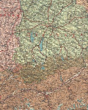
Map


This demo enables you to navigate in the sections of two historical ordnance maps:
- Kingdom of Saxony, scale 1:300000, by A. Herrich, 21st edition
- Kingdom of Bavaria, scale 1:600000, by F. Handtke, 16st edition
Both maps were published by the editor Carl Flemming, Verlag, Buch- und Kunstdruckerei, A.G., in Glogau. The maps do not bear any date. As the two kingdoms existed until the end of World War I, we can assume that the maps were published before 1918.
Kingdom of Bavaria
Orignal size: 3404x4241 pixel
- Change map: Kingdom of Saxony
| |
Overview
|
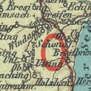
Details
|
Handling
- When the mouse is over the Overview window, a crosshair cursor appears. Press the left mouse button to display an enhanced view of the area under the crosshairs in the Detail window.
- Within the Detail window you can navigate by using the mouse - press the left mouse button to make the point under the crosshairs the centre of the section - or, alternatively, use the four points of the compass buttons.
- A limited selection of locations can be directly accessed by means of the Go to button.